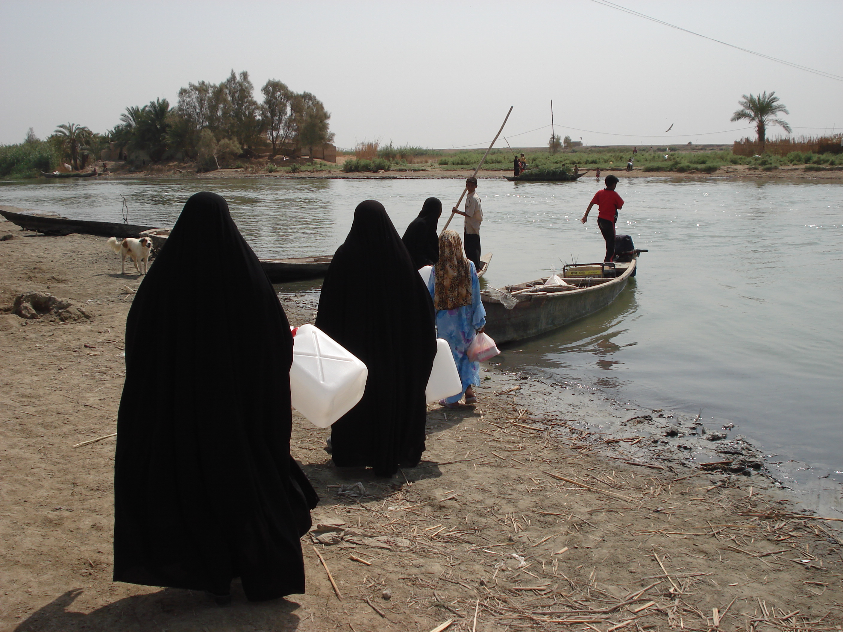
Upcoming Book: The Marshes and the Ma’dan - A Tale of Survival
Background: From 2007 to 2010 I worked for a Canadian International Development Agency (CIDA) project in Iraq. The focus of my research was to monitor and map the status of the Iraqi Marshlands. Having made a number of connections with researchers in Iraq, I continue to volunteer my time to assist them to better understand this vulnerable environment.
The Ghosts of Iraq's Marshes: A History of Conflict, Tragedy, and Restoration
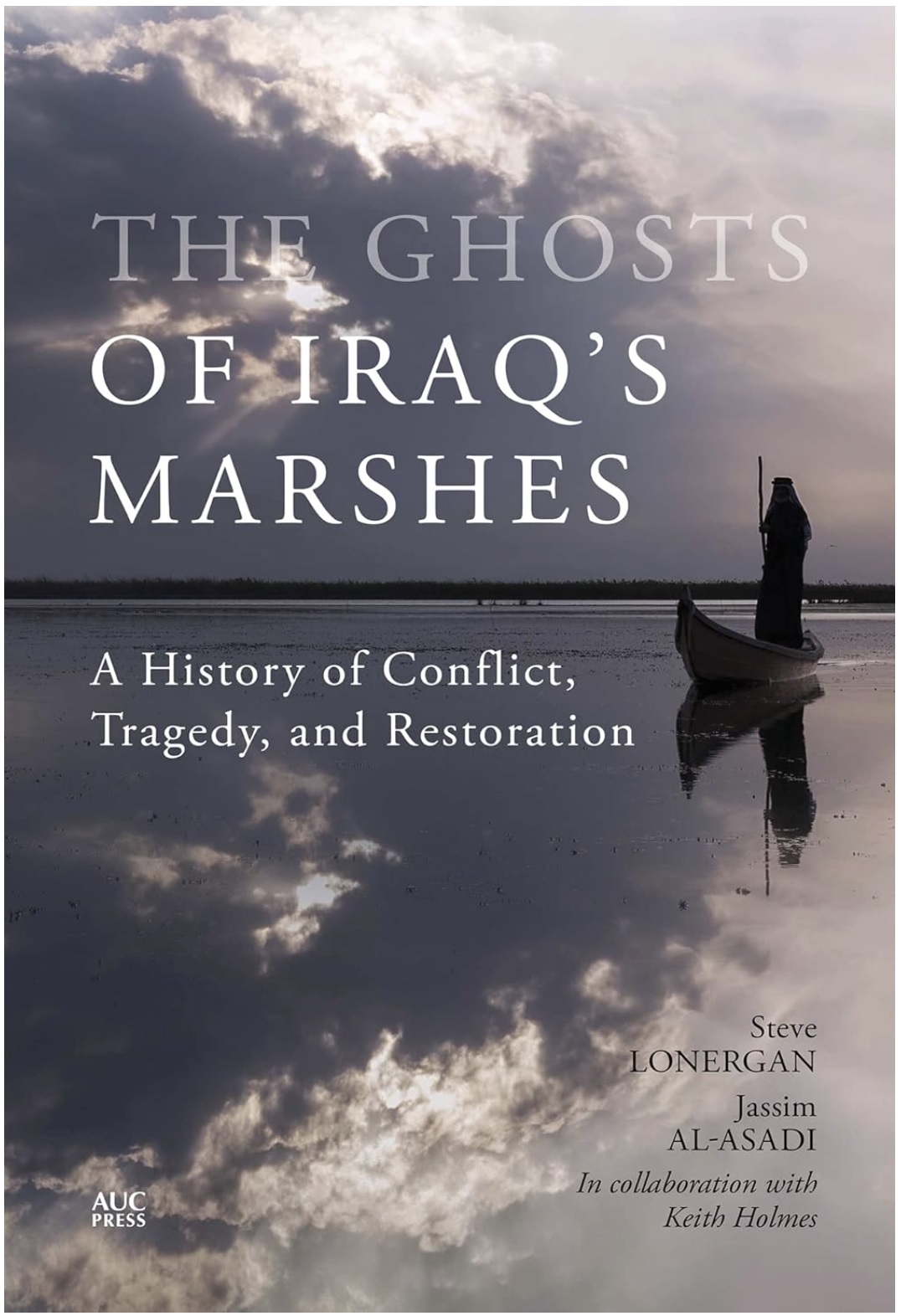
 Keith Holmes
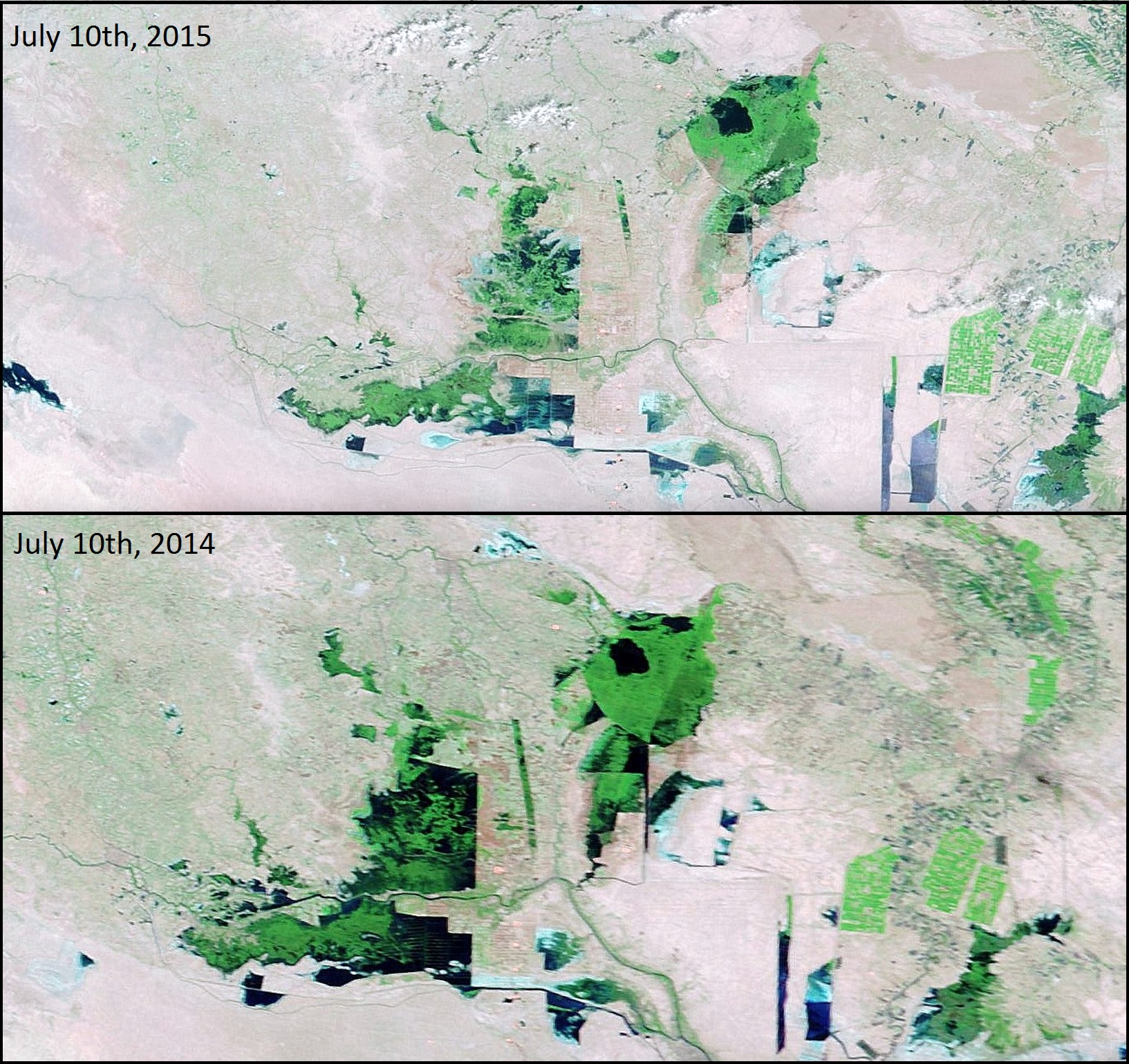
Iraqi Marshes - Comparing July 10th 2014 & July 10th 2015
The water levels in the Iraqi Marshes have been relatively normal to high from 2013 to 2014, but the 2015 levels are much lower. The lower water levels are causing the Marshes to shrink considerably and the dry season has arrived many months ahead of schedule.
Southern Iraq Marshes - Comparison (2008-2012)
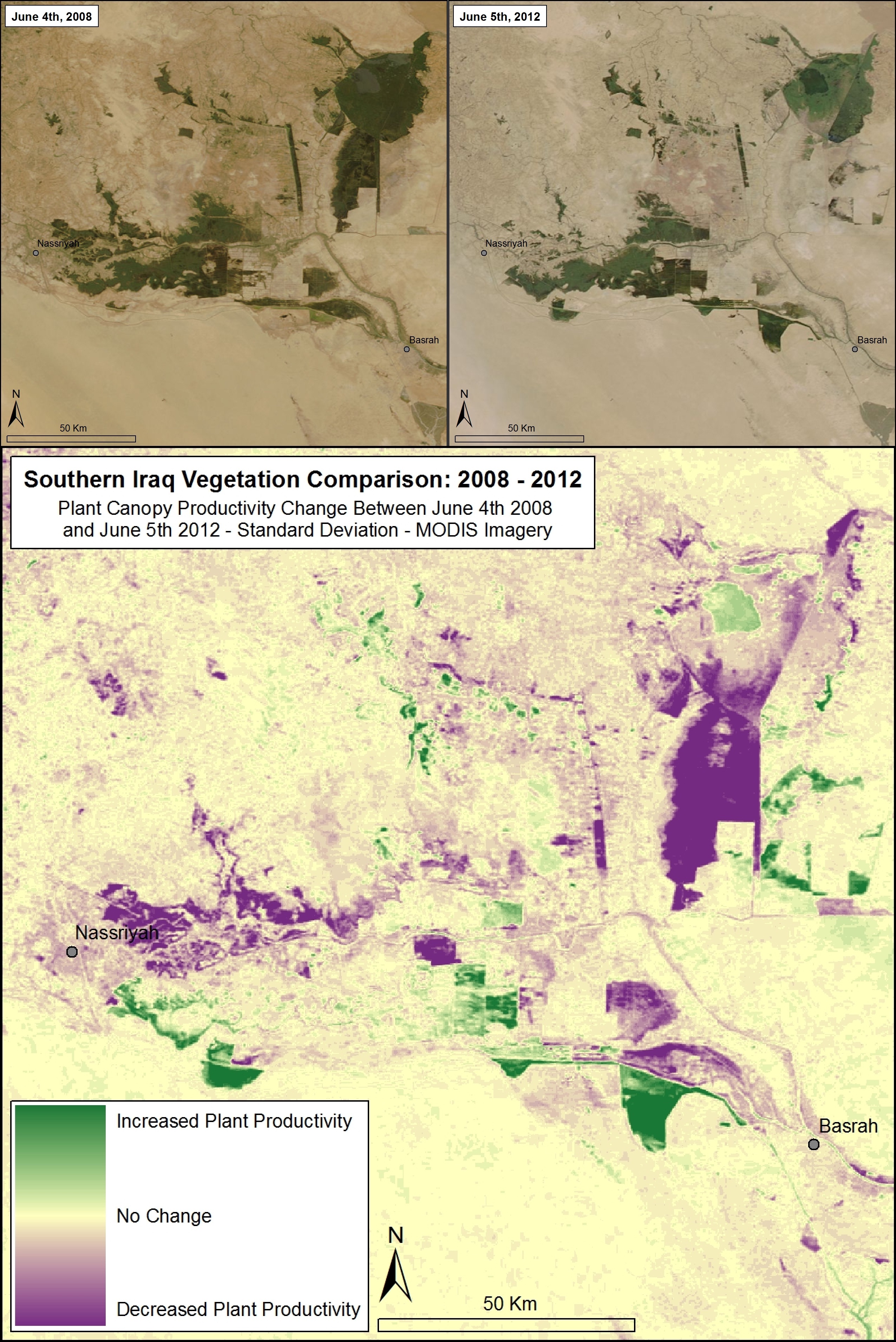
Here we compare vegetation cover from June 4th, 2008 with June 5th, 2012 to highlight regions of the Southern Iraqi Marshes that have changed the greatest in the past four years. Purple regions have the greatest decrease in plant cover, green regions have the greatest increase in plant cover, and yellow represents no change. Some parts of the Iraqi Marshes have dried considerably while some reservoir regions in the south have had an increase in plant productivity. Overall water availability in 2012 is lower than 2008 resulting in a general drying of the Southern Iraq.
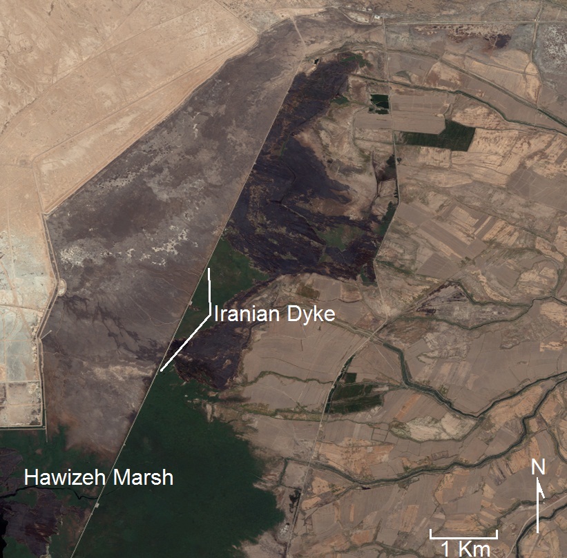
Hawizeh Marsh Threatened by Iranian Dyke
The Iranian Dyke completed in 2009 has been cutting off natural flows of water to the most important Marsh in the Middle East - the Hawizeh Marsh. This image taken in December 2011 shows the blockage of water killing off vast areas of the riparian habitat. The dyke parallels 200 meters away from the Iraq / Iranian border. It is roughly 20 meters across and over 65 Km long - stretching the entire length of the Hawizeh Marsh. This massive levee impacts water resources throughout the governorates of Maysan and Basrah and the decreased water levels are causing greater salinity in the already fragile ecosystem. Solutions would be to perforate or destroy the dyke to allow better flow and allow for better seasonal surges of water to enter the Marsh ecosystem.
IRAQI MARSHES - MARCH 2009-2012
The Iraqi Marshes have gone through considerable change in the past 40 years. March represents the time just before the spring floods arrive - so it represents the low water mark for the year. Recent changes have shown a drying in the Hawizeh Marsh (North East Marsh) and the area of the Marshes have remained between 2,100 - 2,800 km2. Major drought years were in 2008 and to a lesser extent 2010 and trends in water flow to the Marshes is steadily decreasing.
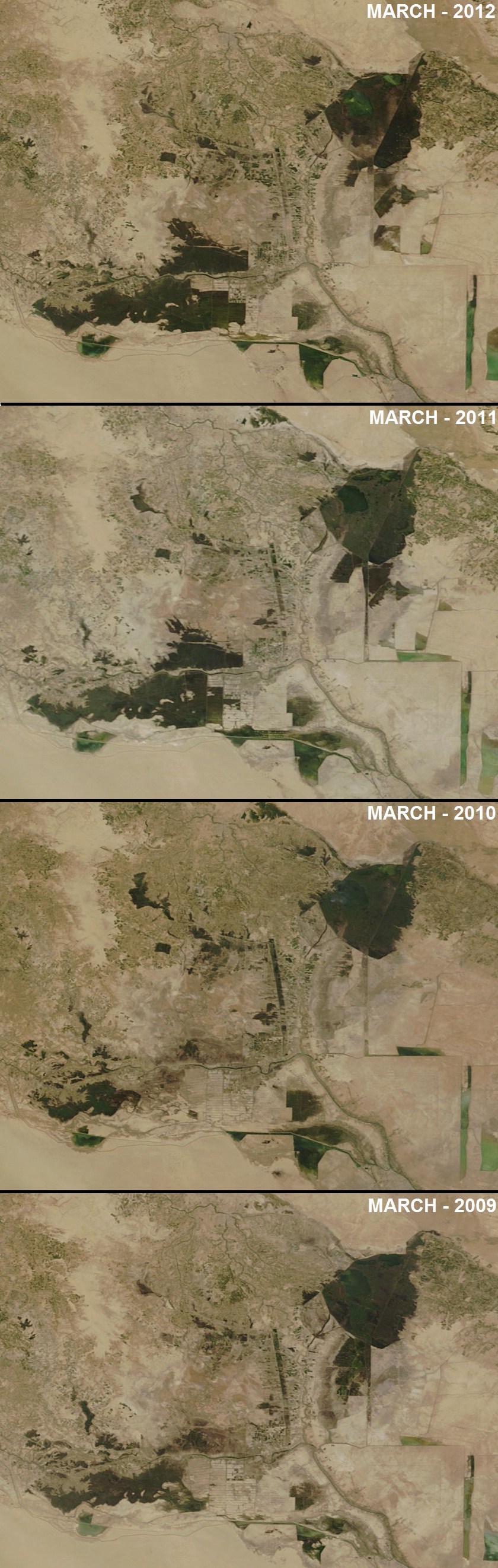 March 23-27th- 2009, 2010, 2011,2012 - USDA - MODIS Imagery
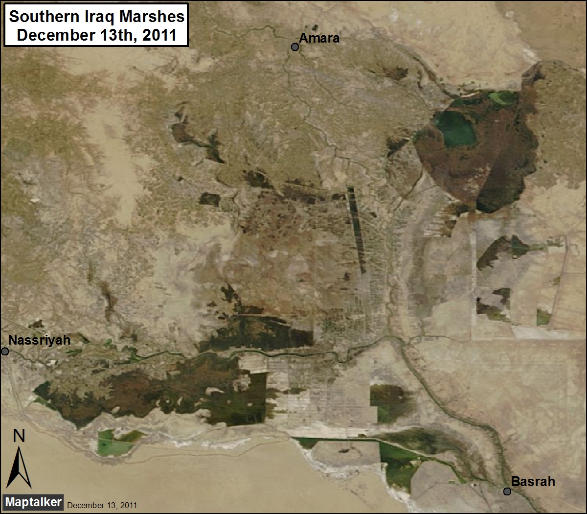
Marsh Update - December 13th, 2011
Marsh view update - December 13th, 2011. The Marshes have remained relatively stable for the past few months. The Iraqi Marshes are currently at roughly 22-23% of their original extent.
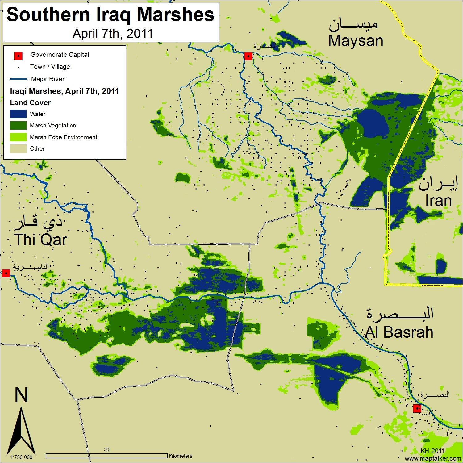
 Land cover analysis map:
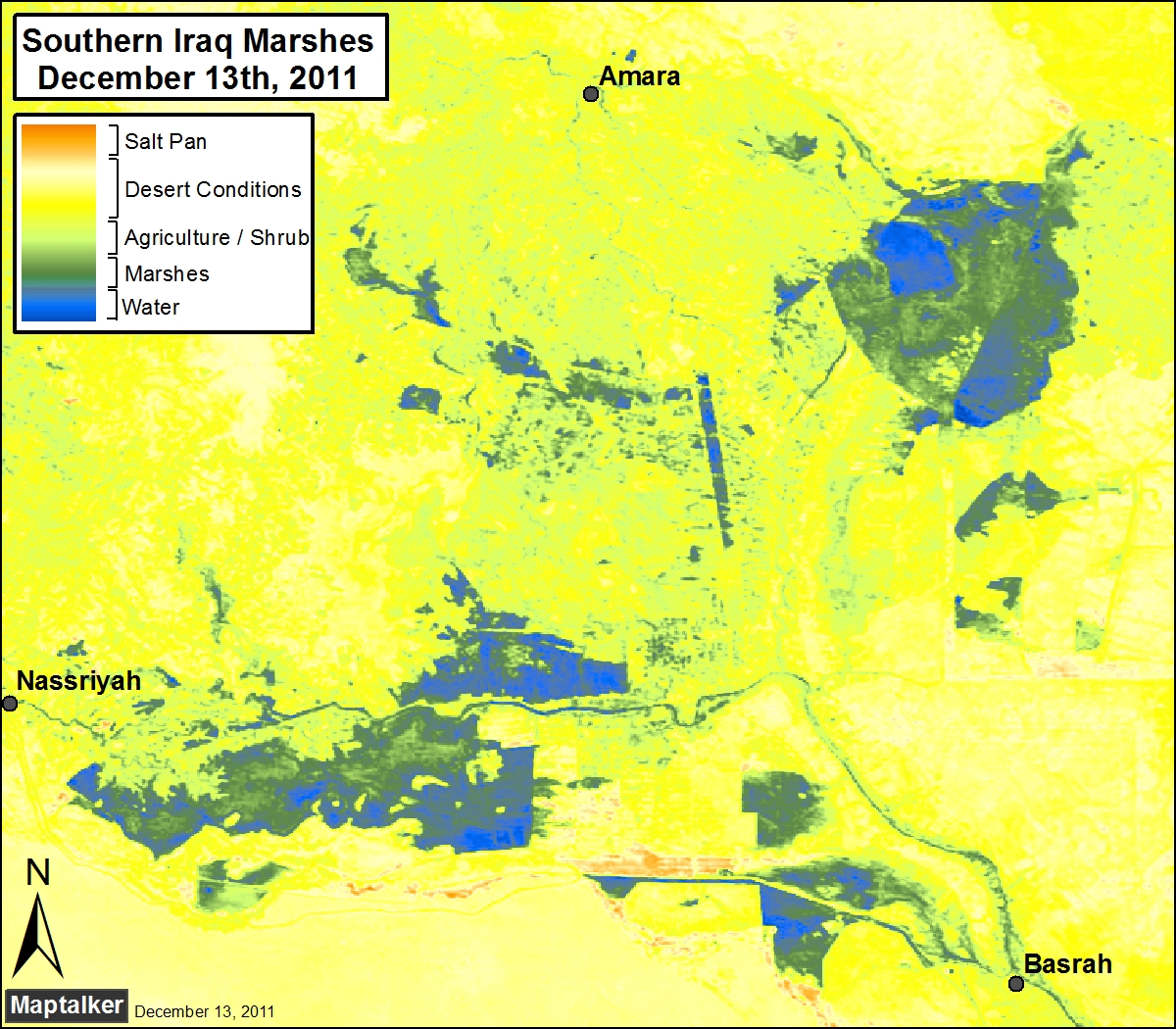
Marshes at 23% of Original Size
Recent MODIS satellite imagery (October, 2011) indicate that the Iraqi Marshes have an extent of 2,400km2 which is ~ 23% of its original size (~10,500km2). The wet season is still a few months away and recent drying in the Hawizeh Marshes will cause the size to shrink even more. Since 2006 the Marshes have been steadily decreasing in size. There are seasonal peaks in water flow around April and May, but otherwise the water levels have been going down. If these trends continue the Marshes will be extremely fragmented and less than 1,000km2 (>10%) by 2018.
Recent article on the status of the Iraqi Marshlands
 Recent article about the status of the Iraqi Marshlands
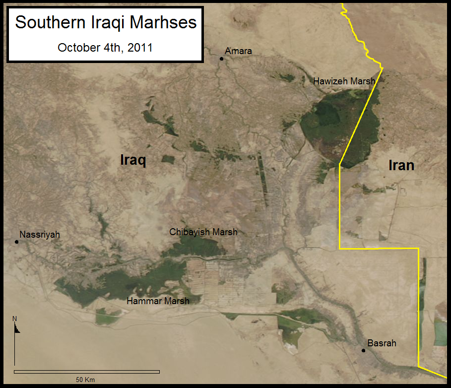
Iraqi Marsh Update - October 4th, 2011
The Eastern Hammar Marsh has remained stable due partly to the diversion from the MOD canal. Chibayish Marshes (North of the Euphrates River) have had relatively stable and increasingly contained boundaries for the past year. The Hawizeh Marsh (historically the most stable) is undergoing great changes due to water shortages. Since the completion of the Iranian dyke in 2009 water levels have been variable especially along the Eastern Iraqi border. This MODIS image shows the drying occurring along the Eastern Hawizeh Marsh which will most likely deteriorate further until the flooding season in the spring. The perforation of the Iranian dyke and natural flow of the Karkheh River must be restored for the Hawizeh Marsh RAMSAR site to be preserved.
Iraqi Marshes Update - May 30th, 2011
Here is a classification map of what the Marshes look like as of May 30th, 2011. Looks like water levels are fairly stable. The extent has not changed too much in the past year with some advances in South Hawizeh Marsh and South West Hammar Marsh. 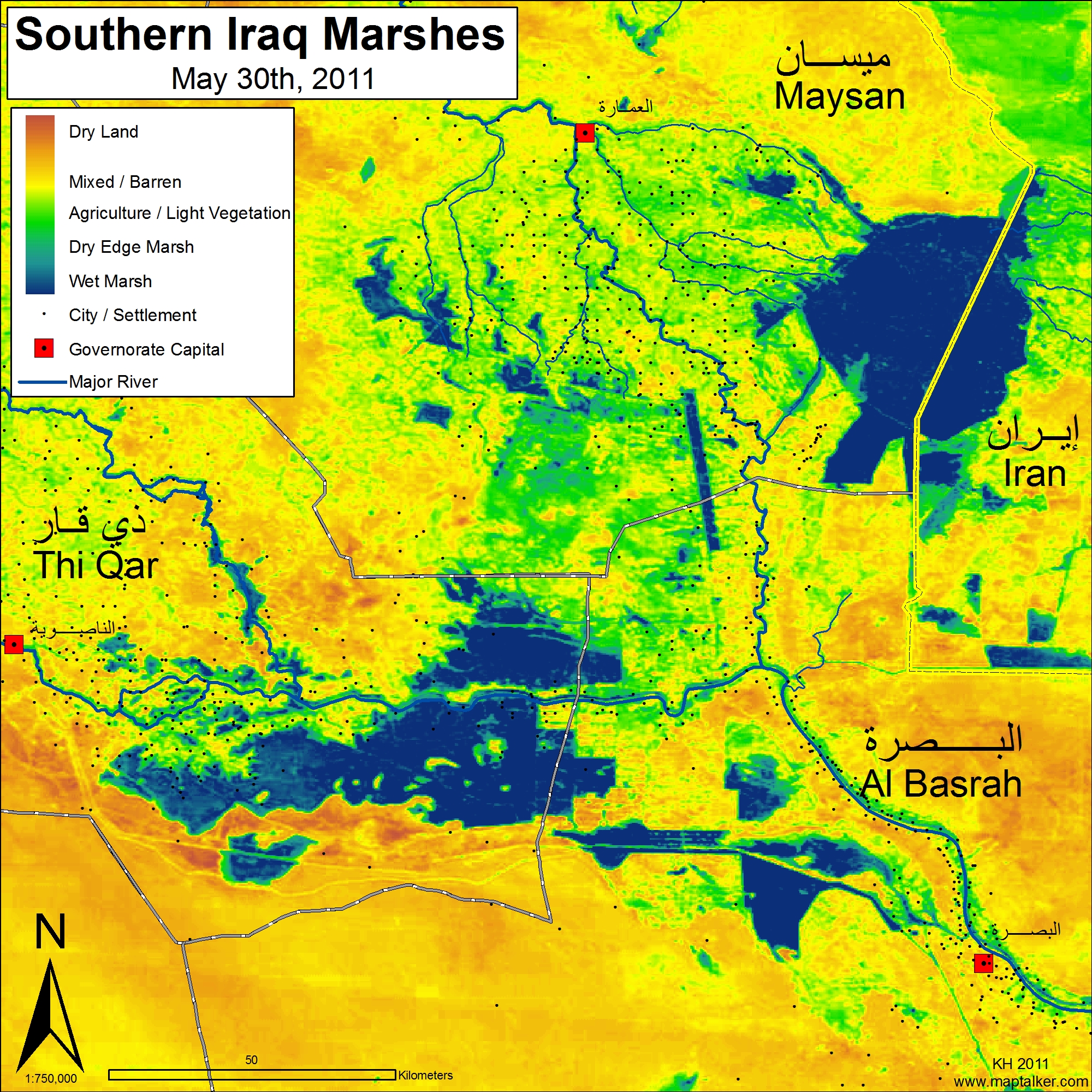
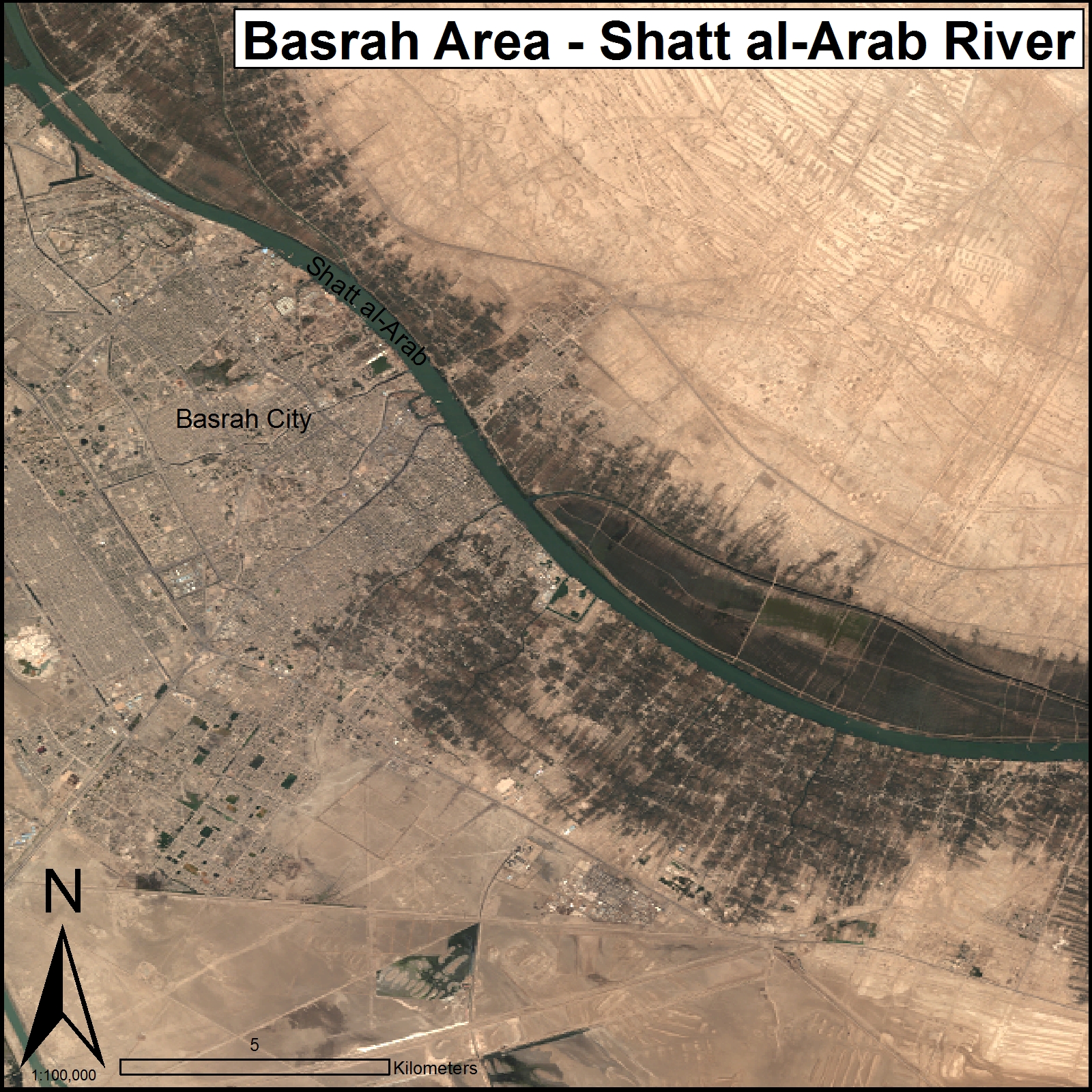
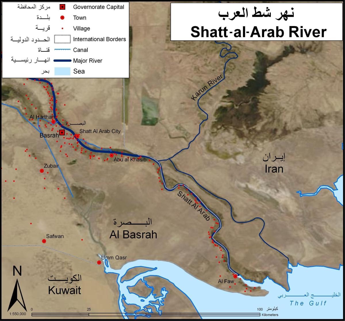
Shatt al-Arab - Iraq.
Basrah and the Shatt al-Arab River in Iraq are threatened by decreasing flows in the Tigris Euphrates Rivers, pollution, and increasingly climate change. The salt wedge from the Gulf is reaching the city of Basrah which has serious consequences for water quality and environmental stability for the people and environment of the region. Solutions to this problem are few. Increased flows from the Tigris and Euphrates Rivers would flush out the salt wedge, but future projections of discharge rates show decreases in water. Other solutions being explored are the construction of hydrologic structures, but this is expensive and complex due to marine traffic, flat topography, and geopolitical issues with Iran.
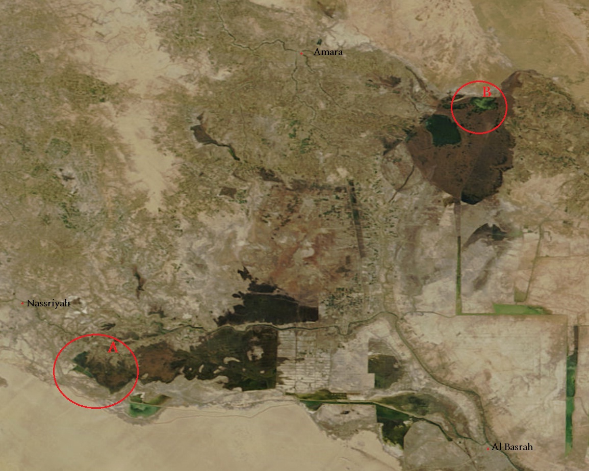
Iraqi Marsh Update - January 13, 2011
This MODIS satellite photo of Southern Iraq (Maysan, Thi Qar, and Al Basrah) was taken on January 13, 2011. The area of Marshes has been fairly stable (between 2,700 - 3,000 square kilometers) in the last four months. Area A on the map has been an region of interest for the Iraqi Ministry of Water Resourses (MOWR). A water channel has been constructed from the Main Outfall Drain (MOD) to divert water to the West Hammar Marshes. This project has been successful although the water quality from the MOD is questionable. Area B on the map is the North Hawizeh Marshes and is of great concern. The Hawizeh Marshes are the largest intact Marsh region in Iraq and satellite data shows it under stress from lower water levels. The Karkheh River in Iran has been shifted to no longer discharge into the Hawizeh Marsh. This was done by the construction of a 65 km long dyke in 2009. This issue must be resolved if this RAMSAR protected Marsh is to survive.
Iraq - Chibayish Marsh - December 2010
The Chibayish Marsh is on the upper side of this photograph (North of the Euphrates River) and is located in Thi Qar governorate, Iraq.
I am surprised how well the Chibayish Marsh looks. Just a year ago much of this area was dry. I am still unsure of this areas future because of future water shortages and how restricted the water sources are for this area.
The Hammar Marsh is large area in Thi Qar and Basrah governorates and part of it is shown on the lower part of this picture (South of the Euphrates River).
The Hammar Marsh has a lot of issues. This section of the central / Eastern Hammar Marsh has poor water quality, low population, and extremes of drought and flooding (currently flooding). Some serious planning is required to correct this area.
I am interested in Geographic Information Systems (GIS), landscape research, and biodiversity. In the past I have done work in the Middle East with the Canada Iraq Marshland Initiative and I want to continue environmental mapping. I have found that maps provide powerful visual aids and can be applied to a variety of topics to get a point across without even saying a word. So I am going to let the maps speak for themselves and I hope you enjoy them.
If there is a map you feel needs to be made please contact me and I will see what I can do. My current projects include: Iraqi Marshes, Canadian oil sands, and homelessness in Victoria B.C. I am always limited by data so if you have interesting information to share I would love to make a map for you.
My goal is to have my maps make an impact in decision making and gain public support to make a difference.
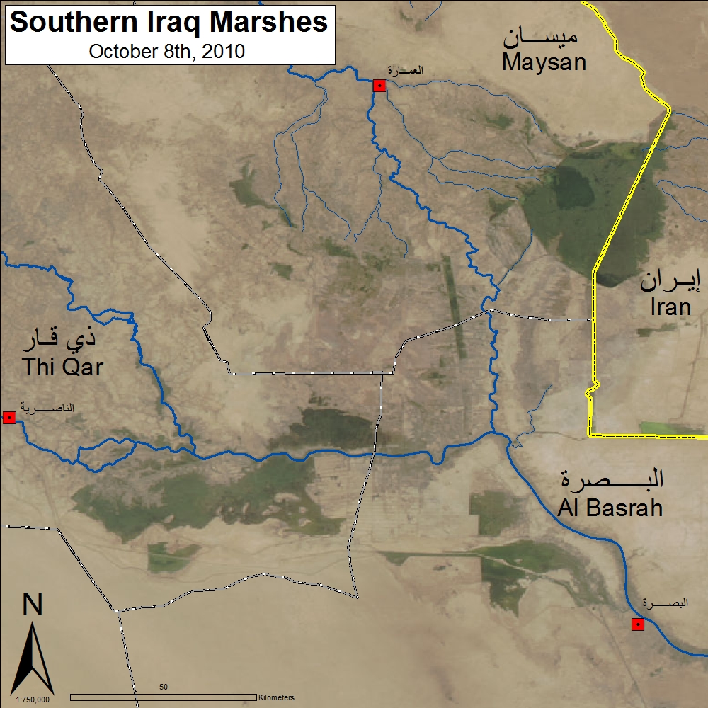
Iraqi Marshes Update
Latest view of the Marshes: October 8th, 2010
The Marshes are showing some recovery from the droughts of the past two years.