Iraqi Marsh Update - October 4th, 2011
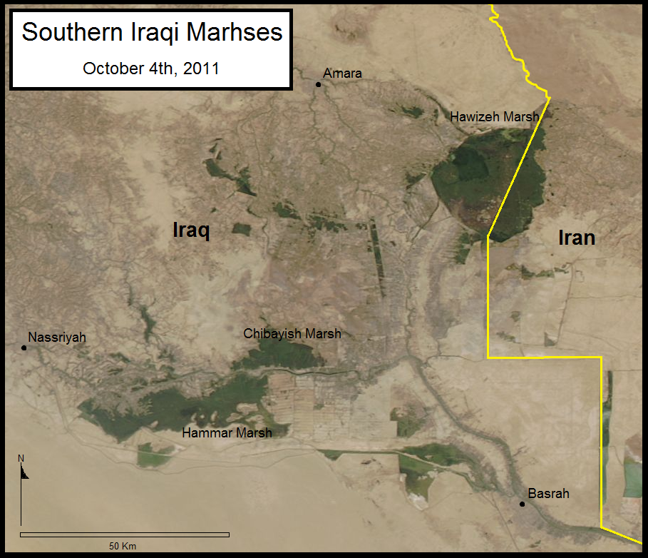
The Eastern Hammar Marsh has remained stable due partly to the diversion from the MOD canal. Chibayish Marshes (North of the Euphrates River) have had relatively stable and increasingly contained boundaries for the past year. The Hawizeh Marsh (historically the most stable) is undergoing great changes due to water shortages. Since the completion of the Iranian dyke in 2009 water levels have been variable especially along the Eastern Iraqi border. This MODIS image shows the drying occurring along the Eastern Hawizeh Marsh which will most likely deteriorate further until the flooding season in the spring. The perforation of the Iranian dyke and natural flow of the Karkheh River must be restored for the Hawizeh Marsh RAMSAR site to be preserved.
 Keith Holmes
Reader Comments