Iraqi Marsh Update - January 13, 2011
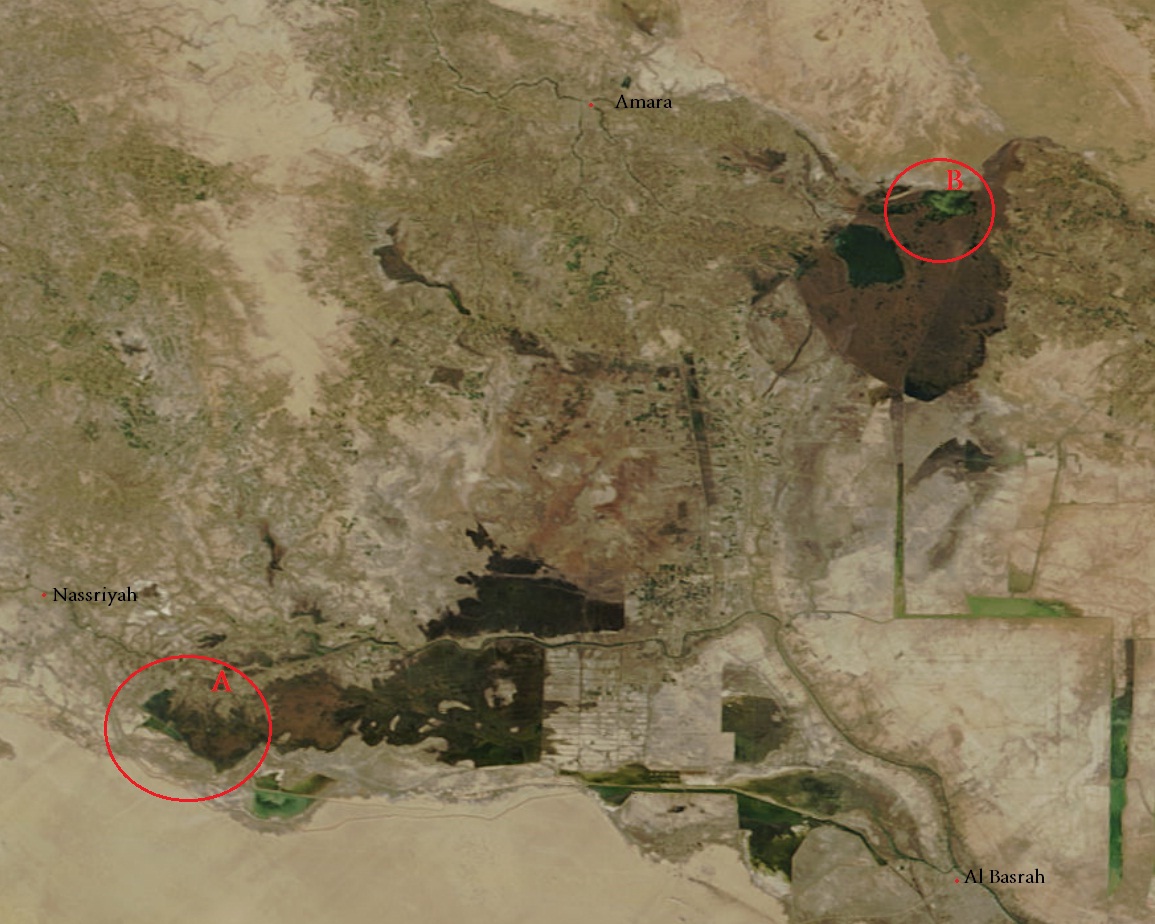
This MODIS satellite photo of Southern Iraq (Maysan, Thi Qar, and Al Basrah) was taken on January 13, 2011. The area of Marshes has been fairly stable (between 2,700 - 3,000 square kilometers) in the last four months. Area A on the map has been an region of interest for the Iraqi Ministry of Water Resourses (MOWR). A water channel has been constructed from the Main Outfall Drain (MOD) to divert water to the West Hammar Marshes. This project has been successful although the water quality from the MOD is questionable. Area B on the map is the North Hawizeh Marshes and is of great concern. The Hawizeh Marshes are the largest intact Marsh region in Iraq and satellite data shows it under stress from lower water levels. The Karkheh River in Iran has been shifted to no longer discharge into the Hawizeh Marsh. This was done by the construction of a 65 km long dyke in 2009. This issue must be resolved if this RAMSAR protected Marsh is to survive.
References (1)
-
 Response: property in ahemadabad are for salethere are property in ahemadabad for sale
Reader Comments